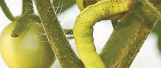
There are recommendations for determining the sides of the horizon based on the tree crown. But the indication that the crown of trees on the south side is more luxurious, and the annual rings of wood growth on the stump of a cut tree from the south are wider than from the north, is not always confirmed.
The fact is that in a deep forest the trees cover with their shadow the neighboring trees located to the north of them. Therefore, longer and denser branches in the middle of the forest can be directed not only to the south, but also to the north, east, west, that is, where there is more free space.
In this regard, the daily increase in the next layer of wood is formed on this side, from which the tree develops better. So, not necessarily from the south side. And if we also take into account that the development of the tree crown, as well as the width of wood growth, is constantly influenced by the direction of the winds and moisture, then the conclusion is clear.
But an exception may be the north, where there is much less heat and light from the sun than moisture, and where trees develop better towards the south. In the middle latitudes of a temperate climate, the north-south direction can only be determined by trees standing in the open.
The sides of the horizon in the forest can be determined by the bark of the trees. It must be remembered that the southern side of the trees, receiving more heat and light than the northern side, has drier and lighter bark. This is especially noticeable in coniferous forests. In addition, on the more illuminated side of the trees there are characteristic nodules and clumps of resin that retain a light amber color for a long time.
It should be borne in mind that pine trunks are covered with secondary crust. On the northern side, this crust forms much less frequently than on the southern side. And after the rain the pine trunk turns black from the north. This is explained by the fact that the secondary crust, which forms on the shady side of the trunk and extends along it higher than on the southern side, swells and dries out slowly during rain. This gives the impression that the north side of the pine trunk is black.
The sides of the horizon can also be determined by deciduous trees. Thus, the trunks of aspens, and especially poplars, from the north are covered with moss and lichens. And even if the lichen has grown all over the tree, there is more of it on the north side, where it is moist and dense. This is especially noticeable along the lower part of the trunk. And the bark of a white birch on the south side is always whiter compared to the north side. And, given that birch is very sensitive to winds, the tilt of its trunk will also help you navigate in the forest.
Large stones and boulders can be used to determine the sides of the horizon. Their northern side is covered with lichens and moss, which do not like heat and light. And the soil near such a stone will help if there are no lichens and moss: the soil on the north side of such a stone is more moist than on the south.
This is interesting: Orientation using a compass: how to use it in the forest, how to determine azimuth, programs for your phone
Mushrooms provide equally accurate information on determining the sides of the horizon. It should be remembered that they grow mainly on the north side of trees, stumps, and bushes. On the eastern and western sides there are much fewer trees, stones and bushes, but on the southern side and especially in dry weather there are almost none of them.
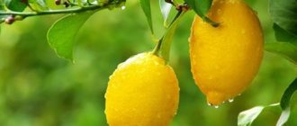
When ripening berries in the forest, you should remember that they acquire color earlier on the south side, ripening faster on the south side of hummocks in swamps.
Its inhabitants will also help you navigate the forest. Thus, the squirrel makes its home only in hollows located on the opposite side of the prevailing winds. And, anthills are located on the south side of a tree or stump. Moreover, its southern side is sloping, while its northern side is steeper.
In spring, snow melts faster on the slopes of ravines, hollows, and recesses facing south. In the spring, the grass is higher and thicker on the southern side of individual stones, buildings, and forest edges, and in summer, during prolonged heat, it remains greener on the northern side. Forest management posts provide excellent guidance in the forest. In all forest areas, clearings are cut in accordance with the forest management adopted in our country in the direction of the sides of the horizon: the main clearings are from north to south, transverse clearings are from east to west. The quarters are numbered from west to east and from north to south, so that the first quarter is in the northwestern corner of the farm, and the last one is in the southeast.
Block numbers are indicated on block posts and at intersections of clearings. The size of the numbers corresponds to the location of the blocks: smaller numbers are in the northwest and northeast, larger numbers are in the southwest and southeast.
In addition to the Sun, Moon and constellations in the steppe, you can navigate by plants. In the southern steppes, such a plant, lettuce, is widespread. This is a biennial weed with baskets of yellow flowers and vertically located on the stem evenly in all directions, and in dry and open areas the planes face west. During the hottest time, lettuce turns its leaves with their edges to the south. This thereby reduces the evaporation of moisture. By using a compass, you can make sure that the lettuce leaves point relatively accurately to the sides of the horizon.
The sides of the horizon, even in cloudy weather, will help to determine the blooming sunflower, the basket of which faces east in the early morning, and strictly south at noon, and west in the evening. At night, the plant head takes a vertical position.
And in the steppe and forest-steppe zones, beets will help you navigate. Remembering that white beetroots grow from east to west, and red ones from north to south, you can use this in the absence of other landmarks.
Due to the fact that cloudy days in the desert are an extremely rare phenomenon, you can navigate by the Sun and Moon. In addition, you can navigate by the dunes. It should be remembered that in summer all the windward, gentle slopes of the dunes face north, and the steep, crumbling slopes face south, since at this time of year northern winds predominate. In winter, on the contrary, the gentle slopes of the dune chains face the south, and the steep ones face the north, because in winter the southern winds blow.
• In populated areas.
Buildings that are quite strictly oriented along the horizon include churches, mosques, and synagogues. Altars and chapels of Christian and Lutheran churches face east, bell towers face west. The lowered edge of the lower crossbar of the cross on the dome of the Orthodox Church faces the south, the raised edge faces the north. The altars of Catholic churches are located on the western side. The doors of synagogues and Muslim mosques face approximately north, their opposite sides are directed: the mosques face Mecca in Arabia, which lies on the meridian of Voronezh, and the synagogues face Jerusalem in Palestine, which lies on the meridian of Dnepropetrovsk.
This is interesting: How to determine azimuth from a map
Temples, pagodas, and Buddhist monasteries face south. The exit from the yurts is usually made to the south. In rural houses, more windows in living areas are cut on the south side, and the paint on the walls of buildings on the south side fades more and has a faded color. Moss sometimes grows on the northern part of the roof.
Ways to navigate the terrain without a compass
The ability to navigate among unfamiliar places is an important quality of a modern, competent tourist. This means, first of all, not to get lost in an unfamiliar place, to establish your location in time by the sides of the horizon and geographical objects, and to find out the direction of further movement.
It’s good when an experienced instructor takes a compass on a hike; this is not always the case in unprepared groups. If tourists find themselves in an unfamiliar area without a compass, there is no need to despair. There are many ways to navigate the terrain without this device and it’s worth getting to know them.
Tree navigation
If tourists find themselves without a compass in an unfamiliar forest area, they need to look carefully at the trees. In the south, the tree crown is more luxuriant and there are significantly more leaves. The densest branches in the dense forest develop here; the sun heats them better. Trees reach out for warmth with every leaf. In the north there are much fewer leaves and branches.
The method is not absolutely correct; allowances must be made for prevailing winds, the presence of moisture, and soil types. It is more reliable to navigate along lonely growing trees than in a dense forest.
You can navigate by the bark in a birch forest; from the south it is always lighter, more elastic and thinner. Roughness and cracks, dark growths form on the trunks of birch trees from the north. Birch is a very flexible, thin-trunked tree in young forests; the tilt of the trunk will indicate the direction of the prevailing winds.
You can navigate by the cut down stump; you just need to carefully examine the annual rings on it. Where the gaps between the annual rings are larger - south, and where the rings are located close to each other - north. It’s good if you come across a clearing with cut trees along the way. Even a few stumps will help confirm your orientation assumptions.
In the forests along which tourist routes pass, there are special signs called tourist markings. They are painted on the trunks along a planned route, always from the nearest populated area.
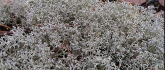
Orientation by mosses and lichens
This is perhaps one of the most popular ways to navigate the area. The trunks of large trees in the forest, aspens, poplars, fir, and cedars from the north are covered with various lichens and mosses due to excess moisture. Even if the entire tree is overgrown with moss, from the north its thickets are denser and wetter. This is noticeable if you examine the trunk at the bottom. On boulders, screes and kurumniks from the north of the stones you can also observe thickets of moss and lichen. These are plants that cannot tolerate direct sunlight, bright light and intense heating. The soil to the north of the stones feels wetter to the touch. Anthills are built by insects in the south of mountain slopes, trees, large stones and stumps for good heating by the sun. Ants are very heat-loving insects and carefully maintain the microclimate in the home. From the south, where the sun warms better, the anthill has a long, gentle slope. The steep slope of the anthill always faces north. The paths of heat-loving ants run from the southern side of the anthill.
Where do ants build an anthill?
Anthill
(ant's nest) - the name of an
ant's
, which, as a rule, is noticeable by its above-ground part, which is a pile of pieces of leaves, needles, twigs and earth (it is the above-ground part of an ant's nest, which consists of a complex system of passages and miniature structures).
Interesting materials:
Who wants to look for opportunities, who doesn’t want to look for excuses? Who can choke chickens? Who can apply for a reduction in cadastral value? Who can challenge a land lease agreement? Who can get a City Plan? Who can change the permitted use of a land plot? Who can remove a building from cadastral registration? Who is in the terrarium? Who discovered the tobacco mosaic virus? Who hunts the owl?
Orientation by temples and glade pillars
This is interesting: Rules of conduct in natural emergencies.
The entrance to the temple and the bell tower are located on the west side, the altar in the church is located on the east. In Catholic churches, on the contrary, the altar is located in the west. For Muslim mosques, it is more difficult to determine the sides of the horizon; they are oriented towards Mecca. Likewise, Jewish synagogues are oriented towards Jerusalem. Although the doors of synagogues and mosques are in the north.
If you manage to find a clearing in the forest, if necessary, you should look for a post with bright numbers on it. They will point tourists to the square number of the topographic map of the area. The smallest numbers of the cutting column will point to the north.
To navigate by the Sun on a bright sunny day, you should wait until midday. At this time, the luminary is at its zenith, any shadow cast by objects becomes short. You should stand with your back to the luminary; the tourist’s shadow will indicate the direction to the north. The south will be behind the traveler. On his right hand there will be an eastern direction, on his left hand - a western direction.
Orientation by the sun and stars
In the off-season, on spring and autumn days, the sun will rise strictly in the east and set in the west. At noon in any season, the star is in the south and every shadow points to the north. On winter days, the sun will rise from the southeast and set from the southwest. On summer days, the sun will rise from the northeast and set from the northwest.
Any traveler has an idea of the constellations of his northern sky. Today, almost every schoolchild can find the stars Ursa Major and Ursa Minor in the sky. But although tourists may theoretically know that the North Star is the end star on the tail of Ursa Minor, finding it can be quite difficult. The advice to help with this is to find the two terminal stars in Ursa Major and mentally continue the line connecting them to the bright Polar Star. Standing facing it, the tourist will look north.
Table: determining parts of the world by the sun
Forest inhabitants will help tourists navigate the terrain without a compass or map. The squirrel inhabits only hollows protected from the prevailing winds. Insect paths on tree trunks are often on the south side. Migratory birds fly north in the spring and south in the fall. In spring, the snow begins to melt on the southern slopes of hollows and ravines, and the grass here is subsequently thicker and taller. In summer, on hot days, there is lush grass on the northern side of buildings, stones, and forest edges. The soil is drier and berries ripen earlier on southern slopes.
other methods
Using a nail, a sewing needle, or a piece of wire, you can make a homemade tourist compass. At the same time, you need to understand that it will point to the magnetic pole and there will be a small error. This piece of steel must be magnetized by rubbing it on wool. In one case, it can be tied on a long thread by the center of gravity, it will rotate and stop in the north-south position. In another case, a magnetized needle is placed on a dry leaf in a small pond, the needle will indicate the north-south direction.
Given all the knowledge about orienteering without a compass, you should remember that you should not use one or two methods. Use your knowledge repeatedly, test it and if several observations are correct, the group will find the right direction.
How to navigate an anthill in the forest
A landmark that will never let you down is a simple anthill. Ants live in almost any area. There are about 12,000 species of them and they adapt perfectly to any conditions. They do not live only in harsh natural conditions, such as deserts and cold northern regions. They are heat-loving insects and predominate mainly in warm regions. In conditions close to harsh, for example, in a temperate climate, they hibernate during the winter.
Anthill orientation
There are a huge number of types of ants and anthills, but the principles of their construction are the same. So, how can you navigate an anthill? The rules of reference are quite simple. Since ants prefer warmth, they build anthills on the south side of trees or other vegetation. Cold winds usually blow from the north, and the wide trunk of a tree serves as an excellent barrier from the wind. If you see a large anthill next to a tree or bush, then south will be exactly in the direction of the anthill from the tree.
There is another important feature of the anthill. The shape of the anthill will help you determine how to navigate the terrain using an anthill. If you find an anthill in a steppe area and it stands separate from the vegetation, it’s not a problem. The fact is that any type of anthill has a flatter shape on one side and steeper on the other. The flatter side is located towards the south, and the steep side is towards the north. This feature is again due to the fact that ants love warmth and the steeper side serves as a barrier from the wind.
However, the anthill is an imprecise natural landmark; the celestial bodies are more accurate.
Where is the queen in the anthill?
The queen lives in the very depths of the anthill, so other living creatures, as a rule, cannot reach her, and some natural “disasters” (something fell from above, a strong wind blew and the ant was carried away, etc.) it is practically not affected.
Interesting materials:
In which city is the airport in Crimea? In which city is there an umbrella alley? In which city in England was the world's first bus manufactured? In which city did Bach create his best works for organ? Which city has the most fountains? Which city has the most snow? In which city was Hitler's bunker? In which city was the first university in Europe founded? In which city was the first Kunstkamera museum opened? In which city was the first museum opened in Russia?
Interesting facts about ants
- The eggs laid by female ants are commonly eaten by Mexicans and Africans. They believe that eggs have a lot of protein and nutrients.
- The longest life expectancy of a uterus is 14 years; the recorded case is a world record.
- African tribes use bullet ant venom in male initiation rites. The hand of a boy undergoing a rite of passage is dipped into a container of ants, after which the hand becomes swollen and very painful. It is believed to induce resilience in boys.
Anthill
Once again, how to navigate the anthill briefly:
- If you find an anthill in the middle of the forest and it grows next to the trunk of a tree or bush, then south is located on the side of the anthill from the tree.
- If you find an anthill in a steppe area, you should pay attention to its shape. The flatter side of the anthill is directed to the south, and the steeper side is directed to the north.
With this knowledge of terrain orientation, you can easily determine where south is and where north is, because it is very easy to remember.
Orientation by moss and lichen
Mosses and lichens do not like heat and light, so they grow in the shady side. This means that where there are mosses and lichens, there is north; on the south side there is less or no moss at all. Now orienteering on moss will not present you with any difficulties. You can also determine the direction by looking at the soil around the stone. On one side it is relatively dry (south), and on the opposite side it is wetter (north). Usually an old, rotting stump is overgrown with moss on all sides. But to determine where north and south are, you need to check the moisture content of the moss, not the soil.
Guide to the shape of an anthill
Often the anthill is located in the south direction from a tree, stump, or bush, and this makes it easier to navigate. However, in treeless areas, it will also help determine the choice of the desired direction. It was already mentioned above that the dome of the ants’ home is asymmetrical.
South direction of the anthill
How to determine where north is: the slope facing this direction is steeper than the one facing south. This is due to the fact that a steep slope better protects the building from the effects of the cold north wind, while a gentle slope is warmed up more easily and quickly by the sun.
In any case, both in the forest and in open areas, a more accurate determination of the cardinal directions is ensured by examining not one, but several nearby anthills. You need to mentally draw a longitudinal line through the center of each dome and see in which direction they all go. This way you can more accurately determine the north-south direction, and, consequently, east-west.
Anthill navigation
Another natural compass that will always help you find the right direction in the forest is anthills . Most of them are located on the south side of a tree, stump, or bush, since ants are heat-loving insects. The southern side of the anthill is usually sloping, the northern side is much steeper. Orientation by anthill. Navigating an anthill is quite simple to remember and understand. In the tundra, as well as in white moss forests (more: What types of forests) and taiga swamps in the north of the European part of the USSR, in Western and Eastern Siberia, in the Far East, lichens (moss moss, or reindeer moss) of the genus Cladonia grow, which serve as irreplaceable food for reindeer, especially in winter. Sources of valuable antibiotics and enzymes, they can also serve as a compass. Darker than the entire lichen, the tips of their branched bushes always face north. Therefore, when going north, you see the dark surface of the moss (lichen) cover, when moving in the opposite direction, that is, to the south, the dark color is not visible, and the bushes seem lighter
Where is the anthill located?
There is little sunlight in the forest. Warm rays barely break through the dense foliage of the trees. And ants are insects that love warmth. Therefore, little hard workers try to get the maximum possible sunlight for the anthill.
They will build an anthill in a place where they are more likely to receive heat. The trunk and crown provide a powerful shadow, which means that the ant house should be placed where the tree will not interfere - on the south side.
It is worth taking a compass with you when going outdoors. He will tell you where the right side of the world is. Or you can check whether it is true that the moss covers the northern side, and the anthill is located closer to the south. This experiment will be useful for children. It will help them better navigate among the trees in the future. If a child gets lost, he can find his way back.
If an insect nest is located in a clearing, then it is worth inspecting its slopes:
- the southern part is flat;
- the opposite side will remain steep.
You need to remember how to navigate the anthill. But it is worth paying attention to other details. So, mushrooms grow from the north of the stump, and berries turn red faster from the south. A dark stripe forms on the northern part of the pine, and the opposite side is covered with sticky resin. This knowledge will help you navigate the thicket and get out of it before dark.
Source
Forest “light bulbs” and “lighthouses”
In order not to get lost in the forest, you need to select clearly visible landmarks in advance, which help determine the location, direction of movement and measure the distance to the intended points along the route. The writer A. Avdeenko in his book “Above the Tisa” talks about his hero Kablukov like this:
“The thick fog did not prevent Kablukov from finding his way. By signs scattered here and there along the patrol path, he easily determined where he was. Here is the rocky bed of a ditch, washed by spring rains, which means that more than a third of the path has already been passed. After fifty steps there should be the stump of an old oak tree. Yes, that's right, here it is. In seven minutes, through the thickness of the fog, the bare trunk of an oak tree, broken by lightning, will blacken, then, on the other, on the right flank, a large boulder will appear, deeply rooted in the ground.”
In areas of the forest affected by honey fungus, there are peculiar, unusual landmarks - “light bulbs”. You are walking in the silence of the forest at night, and suddenly in the impenetrable darkness bright lights of phosphorescent light flash: the growing ends of the rhizomorphs of honey mushrooms glow. Rhizomorphs are plexuses of honey fungus mycelium, very long, shiny black-brown cords, similar to electrical cords. As many rhizomorphs are around, there are as many “light bulbs”. Honey fungus usually settles on stumps and other rotting remains of wood. The mycelium of the honey fungus, covered with a dense shell, is highly branched under the bark of trees, especially weak ones, penetrates with its branches into living wood, sucks the juices out of it and destroys the tree. The ends of the mycelium (rhizomorphs), protruding outwards, glow like bright miniature light bulbs. On a summer night, forest “beacons” can indicate the way along a winding taiga path. These are rotten things , sparkling with phosphoric fire. Rotten stumps phosphorescent most brightly.
Trembling luminous streams “flow” from top to bottom along them. Myriads of bacteria nest here. Bioluminescent microbes contain complex chemicals - luciferin and luciferose. Different bacteria have their own fluorescents, differing in luminescence intensity and color. These lights gave rise to many superstitions. But the cold light at night has a simple explanation. This is bioluminescence, that is, a living glow, especially active in windy weather, with an abundance of oxygen and moisture. It doesn't stop around the clock. So, in order to avoid wandering in the forest at night when returning from a route taken during the day, it is advisable to remember in advance the location of rotting trees or dilapidated stumps, which will serve as kind of light indicators along the way; in addition, orientation by moss or anthill will help you find the right direction. Rating: /5 – votes
How to navigate in the forest if you don't have a compass with you? This question interests many mushroom pickers, hunters and berry gatherers. After all, anyone can get lost in even a small forest area. By what signs can you determine the sides of the horizon? There are various ways to navigate without using special devices. We will look at them in the article.
According to the sun
How to navigate in the forest by the sun? This method can only be used in clear weather. There are several methods for determining cardinal directions.
The sun always rises from the eastern side and sets from the western side. In the middle of the day it is located in the south (in the northern part of the globe). If you are lost in the forest of the Southern Hemisphere, then at noon the sun will be from the north.
How can you navigate in the forest using a watch in sunny weather? The following method will help you determine the north side:
- You need to stand so that the hour hand is facing the sun.
- Mentally you need to draw the angle between the hour hand and the “13” (or “1”) mark on the dial. Then it needs to be visually divided in half by a straight line (bisector).
- Until 13:00, north will be to the left of the sun, and after that it will be to the right. In the Southern Hemisphere, the position of the north will be exactly the opposite.
If you can find a stick in the forest, you can try to make a gnomon pole. However, you can only navigate with it at midday. The stick needs to be dug into the ground. Around noon, the shadow of the pole will point north. For accurate orientation, you need to choose a long enough stick.
Ways to avoid getting lost in the forest
In nature, everything is interconnected and harmonious. Objects that are part of it directly depend on the phenomena occurring around them. They are directly affected by their location on one side or another of the world.
There are various ways to avoid getting lost in the forest. However, in practice, the rule regarding growth rings on a stump is not always confirmed. According to popular myth, they are wider on the southern half than on the northern half. Let's say if the plant is located in a dense forest, the nearest trees will block it from the sun in the north. For this reason, long branches growing densely in the central part of the forest can be directed not only to the north, but also in any other direction.
The direction will correspond to where there is more free space. Accordingly, the annual increase in rings will take place in the area where there are more comfortable conditions for development
It should be taken into account that due to the receipt of more heat and sunlight, the southern part has dry, light-colored bark. This rule is especially relevant in coniferous thickets
Therefore, on the most illuminated side you can find accumulations of resin and sagging that retain their amber hue for a long time.
Pine stems tend to be covered with additional bark. It forms much less frequently in the north than in the south. After precipitation, this trunk becomes black in color from the north. This phenomenon is explained by the slow drying and swelling of the secondary crust formed in the shade. Due to this, the impression is formed that the pine trunk has a black tint, and therefore supposedly points to the north.
Deciduous trees help to recognize cardinal directions well. For example, aspens and poplars are overgrown with lichen and moss from the north. A birch trunk can help with orientation. This breed is susceptible to winds and bends under their influence. To recognize the cardinal directions, you can examine the boulders. They are overgrown with moss on the north side, which does not like light and heat. Even the ground near large stones can tell a lot. On the north side it is usually wet.
As for forest dwellers, squirrels build holes in hollows that are located on the side opposite to the direction of the wind
It is important to remember that the width of annual rings, the location of gopher burrows, and the density of branches on trees cannot accurately tell where which cardinal directions are located. These methods have been found to be incorrect
If any method did not work, there is no need to figure out why this might have happened. It’s better to immediately try another well-known technique. You can determine which methods work by yourself in practice.
By plants
How to navigate in the forest without a compass on a cloudy day? After all, it is possible to determine the sides of the horizon by the sun only in cloudless weather. In this case, you need to take a closer look at the trees. The following signs will help you navigate correctly:
- You will notice that one side of the bark is darker in color, and the other is lighter. This feature is most pronounced in coniferous trees. The dark bark is on the north side. Its color is due to less exposure to sunlight.
- It is also necessary to focus the removal on the resin of coniferous trees. Its greatest concentration is observed on the south side. And the growth of mosses, lichens and fungi on the bark is more often observed in the northern part.
In the summer, you can take a closer look at the color of the berries. They usually ripen faster on the south side. And the part of the berries that faces north has a greenish color.
Additional landmarks
In addition to the shape and location of the anthill, you can navigate the terrain in natural conditions using other folk methods proven over centuries.
- One of the most famous ways to determine the cardinal directions is by looking at the moss on a tree trunk. It is based on the fact that mosses and lichens prefer cold and damp living conditions. If there is not much moss on a tree, there is actually noticeably more of it growing on the north side. If the tree has aged thoroughly and is thoroughly overgrown with moss on all sides, move away from the tree a few steps and take a closer look at the color of the vegetation on it. The moss lichen, also called reindeer moss, lives exclusively on the north side of the tree. The tips of its threads are darker in color than the bases. Therefore, on the cold northern side, the color of the moss will be noticeably darker than on the illuminated southern side. This is a fairly simple way to navigate the forest using moss.
- If there are mushrooms growing under a tree or on a stump, usually honey mushrooms, you can also determine the direction of the world if there are not too many of them. Mushrooms prefer the more humid, shady side - the northern side.
- Wild berries (strawberries, blueberries, lingonberries) ripen faster on the south side of wooded areas. If you look closely, strawberries begin to ripen on the southern, heated side.
- An attentive traveler may notice that the grass on the northern, shaded side is damper and greener than on the southern side, which dries out much faster.
- The bark on trees on the south side is much lighter and cleaner. Cracks and growths often form from excess moisture on the north side. This is especially noticeable in birch forests.
By animals
How to navigate the forest by observing animal behavior? At certain times of the year, the sides of the horizon can be determined by migratory birds. In autumn, their flocks fly towards the south, and in spring – towards the north.
If you find an anthill, you can use it to find your way. You need to pay attention to its shape. In the northern part the anthill has a steeper slope, and in the southern part it is gentle.
In summer it is also useful to take a closer look at butterflies. It is necessary to monitor the behavior of these insects during rest. When a butterfly lands on a flower, it holds its wings in a folded position. In this way she tries to protect them from the sun. In the morning, the folded wings face the east, during the day - to the south, and in the evening - to the west.
Incorrect anthills for orientation
Is an anthill always an impeccable landmark? Unfortunately no. And this, for the most part, depends on its location. If the ants have built their home on the edge of a dense forest or near a road, then it is better to look for another dome-shaped structure to use as a landmark.
Anthill on the edge of the forest
Note! A family of forest workers always locates their house in the most optimal way in order to more efficiently use solar heat, but in these cases the direction of the main axis of the anthill can be shifted and run from west to east or in the north-west direction. Then you should use other methods. For example, branches facing south grow thicker on trees.
Remember this method yourself and tell your children how to determine the cardinal directions by the location of the anthill, its shape, and other signs, so that if you find yourself in a difficult situation, you can use the information received. It is useful to demonstrate to children visually, with a device in hand, that natural landmarks are indeed quite accurate. You can also use the hour hand of a wristwatch for clarity. It is also necessary to explain to children that anthills cannot be destroyed, since their inhabitants bring great benefits to the forest.
Have you learned anything new? Share in the comments!
Through forest clearings
Let's consider orienteering in the forest along clearings. These days, many large green areas are divided into neighborhoods. Between these squares there are paths - clearings. They are cut in the direction north - south or west - east. At the intersection of these paths, special poles are installed, which can serve as a fairly reliable guide.
These posts are tetrahedral logs driven into the ground. On each side there are numbers written that indicate the number of the quarter. You need to take a closer look at them. You need to find two faces with the smallest digit values. The edge of the pillar between them always faces north.
How to determine where North South West East is?
On modern geographic maps, the north side is usually at the top: in this case, the south is at the bottom, the west is on the left, and the east is on the right. On ancient, and sometimes modern maps, the south or east could be placed at the top.
Interesting materials:
What font should I use for Spurs? What font is used in Windows 7? What font is used in Word for documents? What is the fine for selling antibiotics without a prescription? What is the penalty for overstaying a security guard's license? What is the barcode of Georgia? Which green manure is better to plant after garlic? What internet speed is enough for Skype? What's the next movie after Angelique and the King? Which layer of the atmosphere is furthest from Earth?
At night
How to navigate the forest at night? It is not recommended to actively move around at night. There is a high risk of injury or attack by wild animals. It’s better to wait out the night by the fire. However, if you need to get out of the forest after sunset, you can try to navigate by the stars.
We need to find the constellation Ursa Major in the night sky. It looks like a ladle. In Russia, this constellation can be seen in any season. Its two outermost stars (the handle of the bucket) face the Polar Star, which is part of Ursa Minor. This is a constellation of a similar shape, only smaller in size.
You need to mentally connect the “bucket handle” with the North Star with a straight line. This direction will point north.
On a clear night, you can try to find the Milky Way in the sky. This cluster of stars has the appearance of a strip. It runs strictly in the direction from north to south.